THE NEW STANDARD IN SURVEY GRADE
AUTONOMOUS, LIDAR MAPPING
WHAT WE DO
Through our solutions we automate the collection and analysis of data in challenging GPS-denied environments, delivering revolutionary efficiency, safety and operational insights to underground mining and other industries. Our core areas of expertise are drone autonomy, SLAM-based LiDAR mapping and data analytics.
INDUSTRIES
Our solutions are adaptable to a range of industries that require LiDAR mapping and/or inspection in challenging inaccessible areas.
INFRASTRUCTURE
Break free from GPS to get up close to assets with complete spherical awareness integrated directly into flight control.
SURVEY & MAPPING
LiDAR can penetrate foliage from above and enable autonomous flight under the canopy giving you the detail you need

Hovermap is a smart mobile scanning unit that provides autonomous mapping in challenging inaccessible areas. Equally capable above ground or underground, indoors or out, Hovermap is your complete mobile LiDAR mapping solution.
GPS-Denied Flight
Collision Avoidance
SLAM-Based 3D LiDAR Mapping
Allows flying indoors, underground or under bridges.
Omni-directional LiDAR-based collision avoidance keeps the drone safe while flying up-close to structures to inspect them.
SLAM (Simultaneous Localisation and Mapping) allows mapping even when GPS is unavailable.
GAIN ACCESS TO INSIGHTS
THAT HAVE NOT BEEN POSSIBLE BEFORE
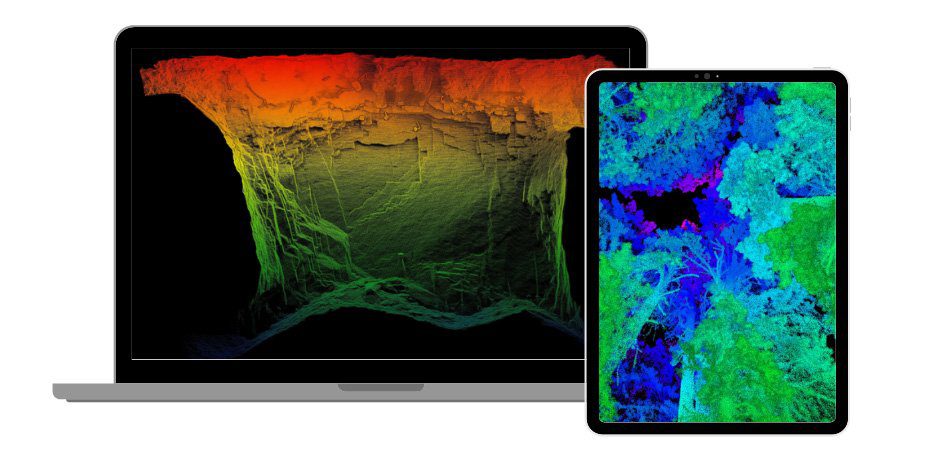
Go beyond what the eye can see and gain unprecedented insights to areas that have not been mapped before. Hovermap’s advanced autonomy capabilities allow you to unlock above and below ground data with confidence and safety.
VERSATILE DEPLOYMENT OPTIONS
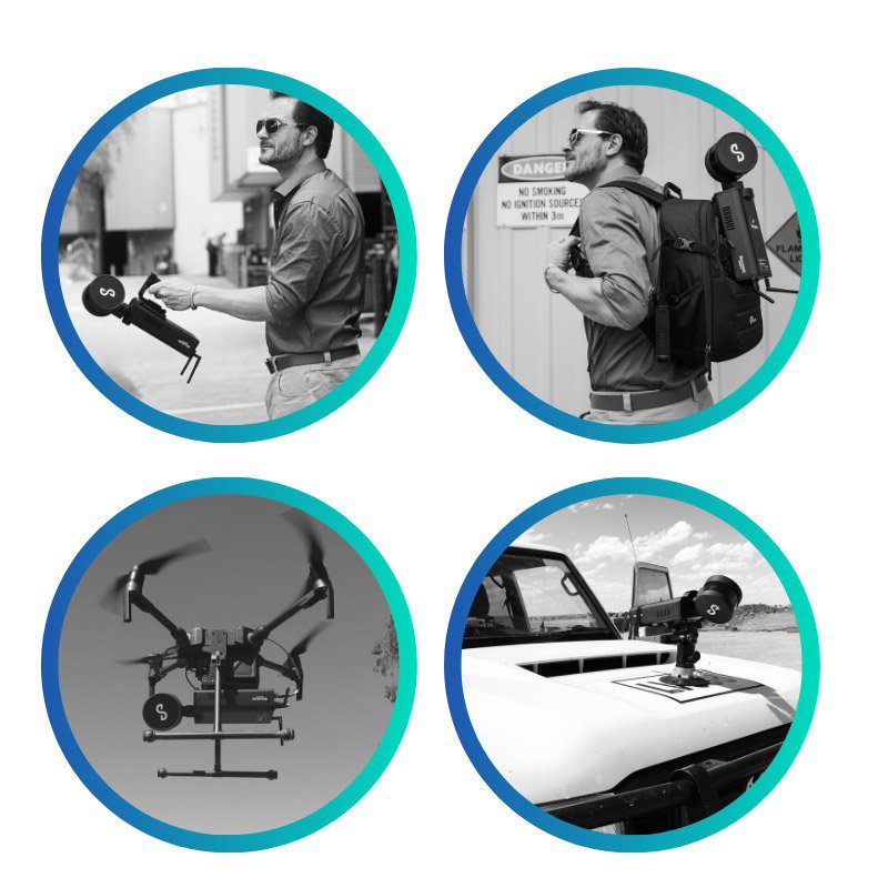
Hovermap’s versatility allows users to switch easily from drone to handheld scanning or to mount it to a vehicle or backpack to enable the collection from previously inaccessible areas, either from the air or on the ground.

AUTONOMY
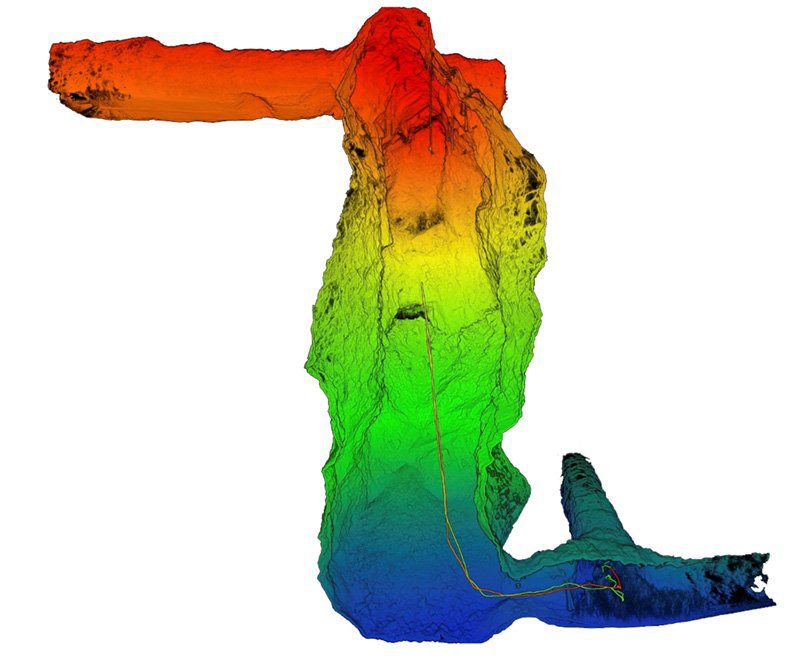
Send Hovermap beyond visual line of site and map areas that have never been mapped before.
Hovermap’s 360 degree Virtual Ellipsoidal Shield technology provides industrial-grade collision detection and avoidance capabilities that can keep drones safe during all phases of flight, in any environment (underground, indoor and outdoor), day or night.
TESTIMONIALS
What Our Clients Say About Hovermap™
” The Abiogeny Hovermap drone was the only one that worked reliably underground. Their scanning and SLAM technology were unmatched and you can remove the scanning/SLAM unit from the drone and mount it on a mine tractor, or a ground robot, lower it on a tether for vertical openings, or even hand carry it. This provides unlimited flexibility.”
IAIN ALLEN
– From the largest gold mining company in the world
“UAS Inc. have been using Hovermap commercially to map stopes and other underground areas since October 2017 and it has had a huge impact on our business. We’ve mapped more than 100 stopes and the system has performed flawlessly.”
MATT MCKINNON
– Manager of Technical Development at Unmanned Aerial Services Inc
“The drone has given us the ability to remove shadow from our scans and increase the accuracy of areas with no human access.”
– From Australia’s leading gold mine
“We rely on Hovermap every single day for our underground stope scans.”
– From a multinational mining, metals and petroleum company
DOWNLOAD
A HOVERMAP™ DATASET
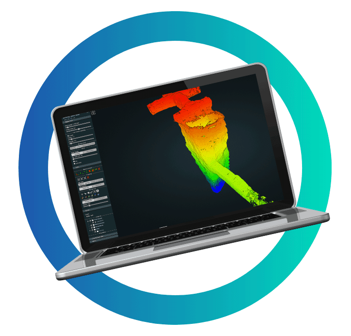
See first hand the quality of a Hovermap Dataset.

SUBSCRIBE
Stay up to date with Abiogeny’s latest news, updates and newly released products. No Spam, we promise!
